
Very quiet here (as opposed to the other Payette Lake).
Finally, I saw this sign.
Woo Hoo! Of course, Mama Cass was also thrilled to get to the gravel/dirt. Now she was in her element!
The road started going up pretty quickly. I was soon in super granny gear. That was like ringing the dinner bell for the mosquitos. A swarm settled down to dine upon my legs and arms (biting through the sunsleeves). Never fear, Ben came to my rescue. I had, wisely, placed the bottle of Ben's 100% Deet in a small pocket of the mountain feed bag (the one holding my bear spray). Quick as you can say, "Dinner's done!", I had coated my legs, and arms (I know you're not supposed to put Deet on clothing, but I didn't care). That did the trick, and I was soon back to pedaling.
There were a few short downhills, and some flats, but mostly I was climbing. Here's what the road looked like.
I was going to top out at Lick Creek Summit at 6880 ft. Other than the fact that it was a steep climb, the worst part was the surprising number of vehicles. Everything from cars, trucks, motorcycles, and even dune buggies (maybe they are called something different when in the mountains). See how dry the road is in the photo above? So that made for some pretty good dust being kicked up. At least most of the vehicles slowed down when they got close to me.
When I got to the top, the dune buggies were there. I asked if it was the summit. The guy said it was about 3/4 of a mile more. However, the road appeared to be going down. Yes, that was the summit. Here's a photo just before, and one just after. There wasn't a summit sign anyway.

Before
After
I came down for a little while until I came to the Duck Lake Trailhead. I pulled in and had some lunch. 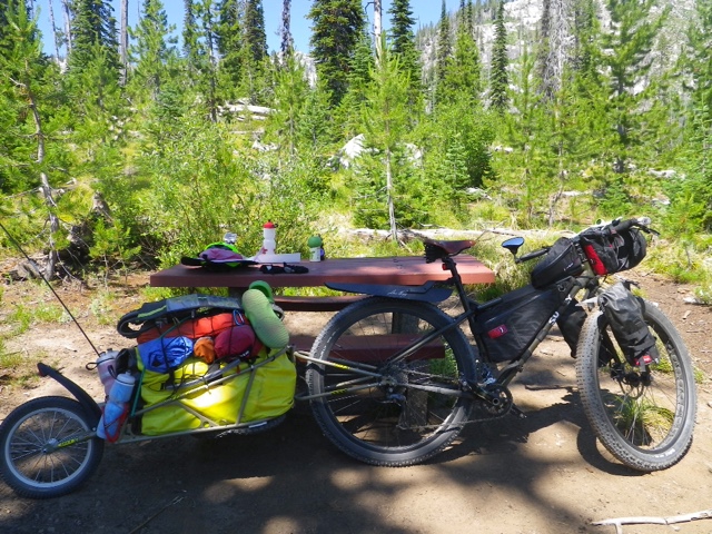
Nice picnic table at the trailhead.
Then the descent really began!
All the way dooooowwwwnnnn!!!
With the high number of rocks and washboard, and most of all, the fact that Johnny P had to come too, I had to control my speed. I think the fastest I got going was about 25. But mostly I kept it at 15 or so. All in all, it went pretty well.
I had been thinking I would stay at Ponderosa campground (so I could say I went from Ponderosa to Ponderosa). But, when I got there, it was only 1:00. I decided to continue to Buckhorn Bar CG. According to my itinerary, Buckhorn was where I was planning for today anyway. I just added the nine miles I didn't do yesterday.
At Indian Point, the road was paved. It was only a single lane, but no more gravel for today. 
Following the river.
I came to Buckhorn Bar Teepee Loop. I'm not sure if this is the real Buckhorn CG, but there is piped water and a pit toilet. It's also on the river. There are only three sites, so I think it's not the real campground. I have a nice spot in semi-shade. I went for a swim in the river. It felt great!
Tomorrow will be more pavement, as this section is 32 miles. Here's a photo of the map of today's ride. Ponderosa State Park is near McCall. My finger is at Buckhorn Bar.
Total miles today: 41.34
Average: 7.34
No comments:
Post a Comment